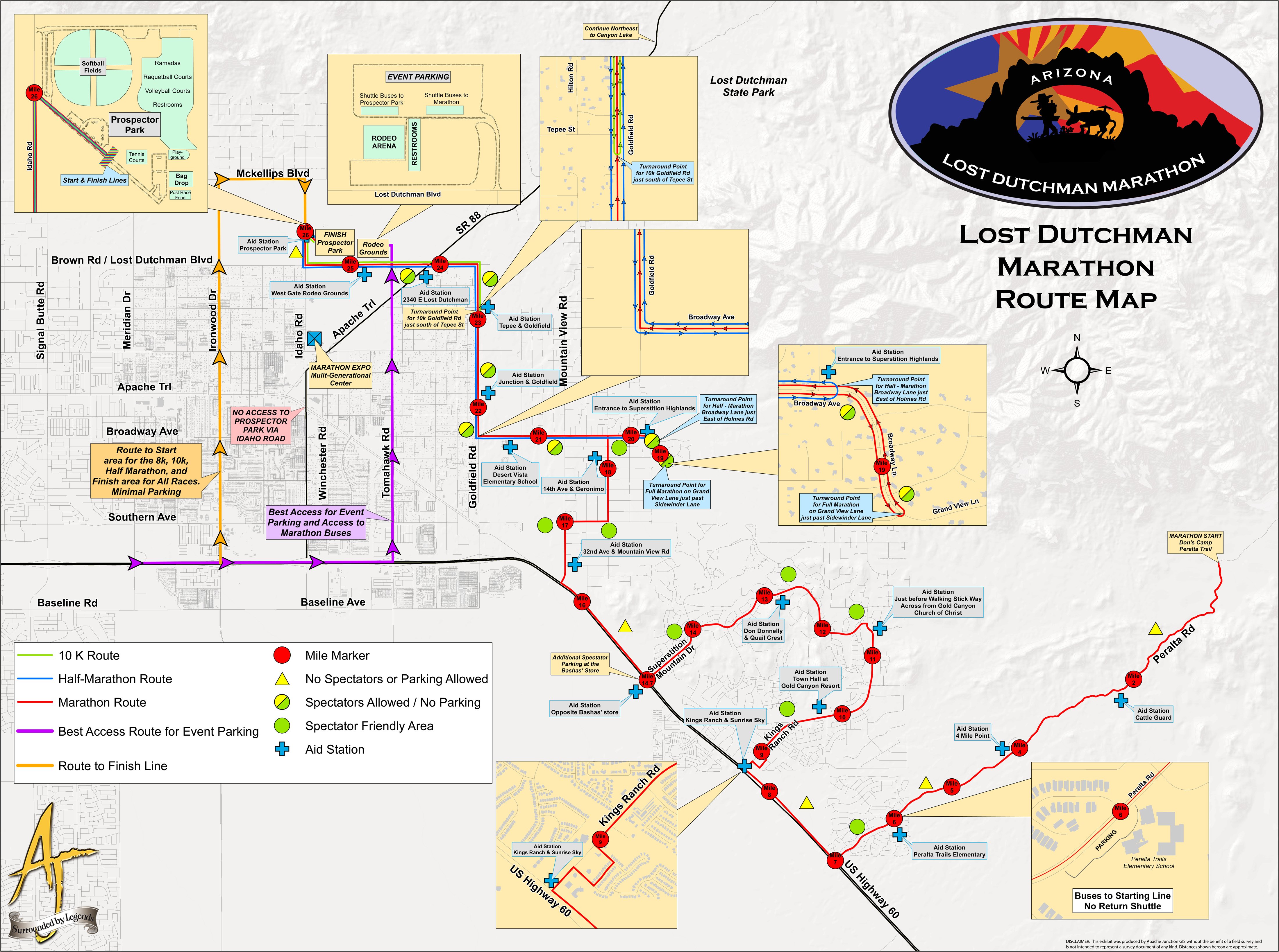
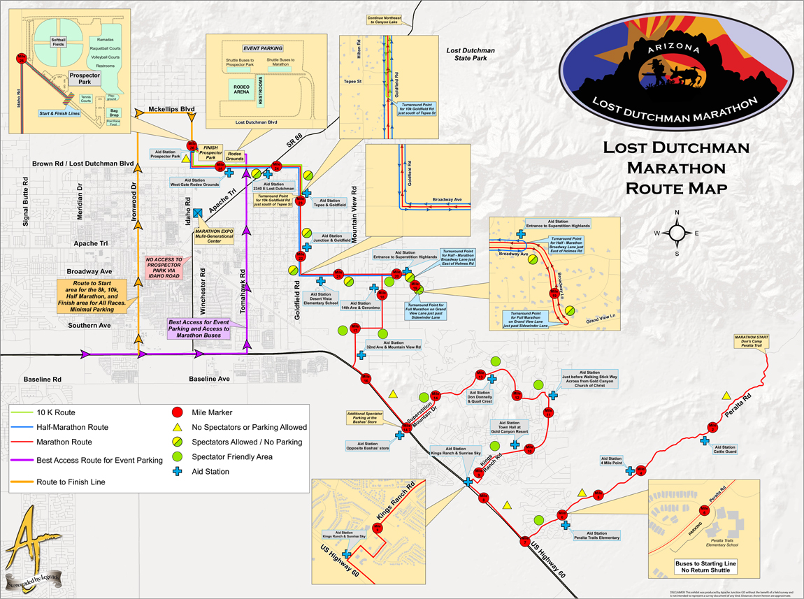
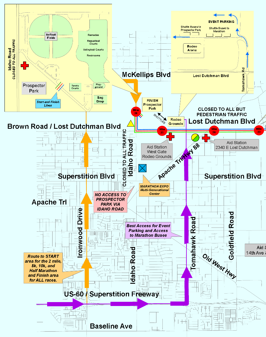
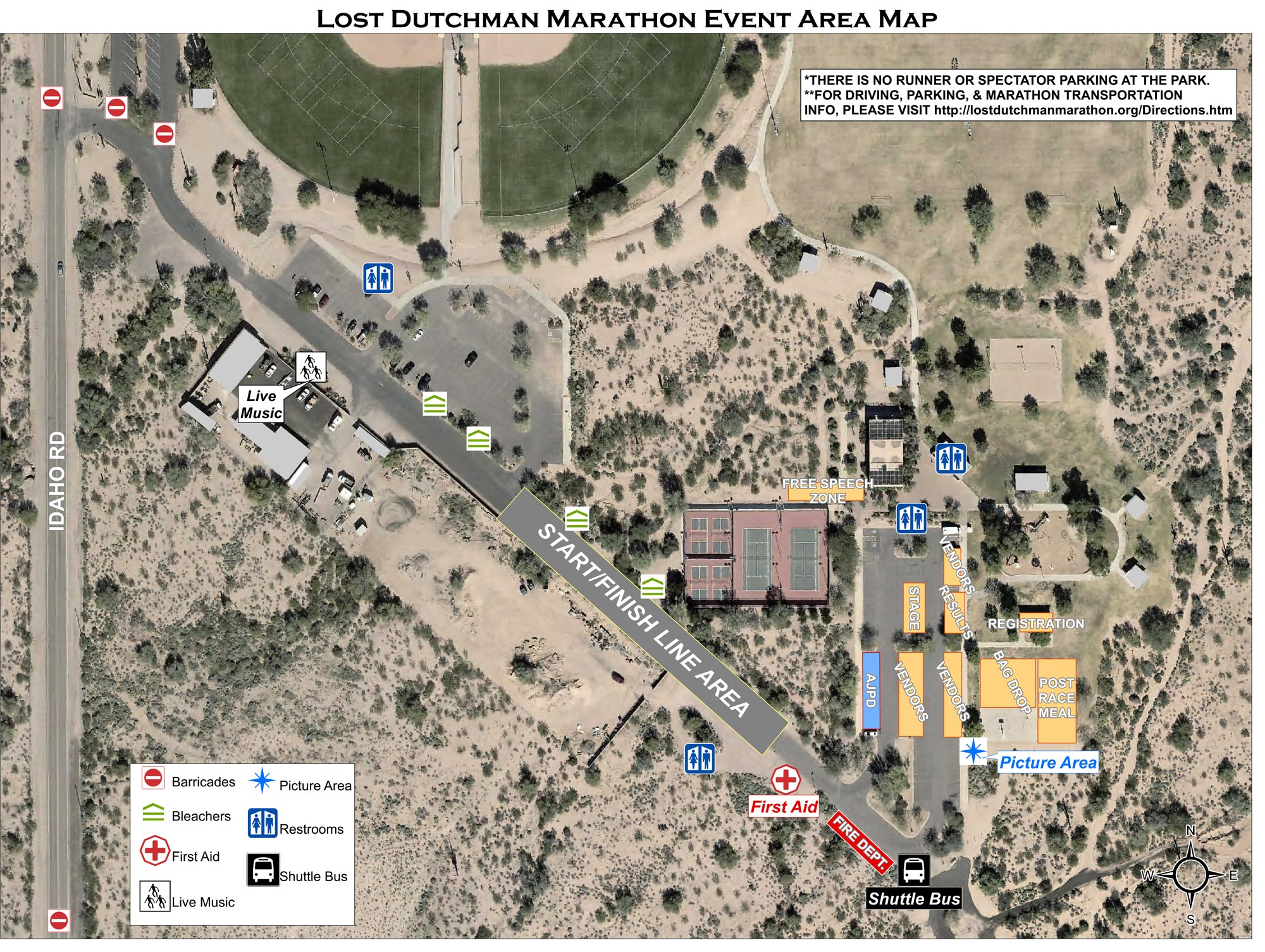
Lost Dutchman Marathon Course Maps
Maps for all courses except 8K: full size .pdf | one page .pdf (print ready) | large .jpg | small .jpg
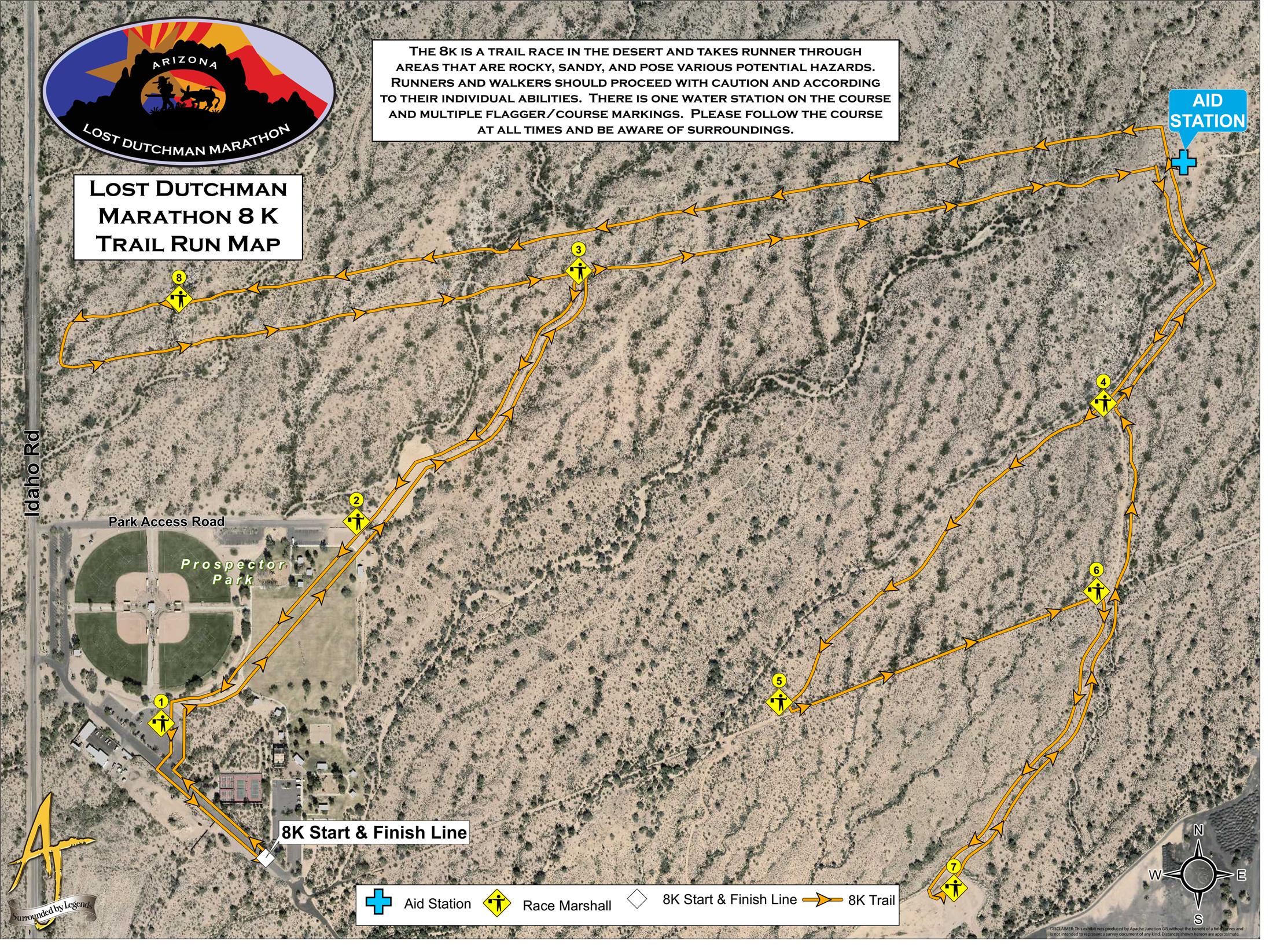
8K Map 8K Desert Trail Run Map
The marathon start and the first six miles were absolutely magical with the pre-dawn campfires, full moon, and then the sunrise giving way to a beautiful desert scape!
See event pages for course descriptions: